Common Scuba Diving Navigation Mistakes: Spatial Orientation, Compass Discipline, and Subaquatic Wayfinding
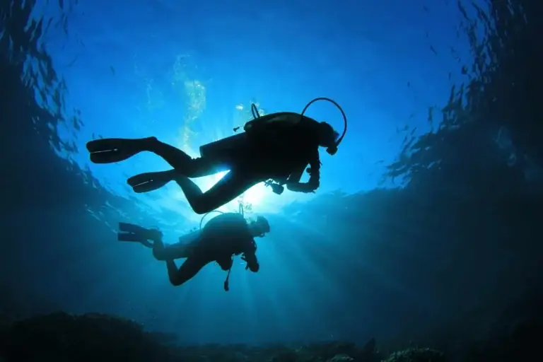
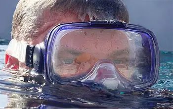
Human spatial orientation evolved entirely within terrestrial environments governed by clear horizons, predictable gravity vectors, and distant visual landmarks. Submerging beneath the ocean surface strips away these perceptual anchors instantly. Water refracts light differently than air, magnifying objects by roughly thirty-three percent while compressing perceived distances. Suspended particulate matter absorbs color wavelengths rapidly, reducing visibility to narrow monochrome cones where distant terrain disappears into uniform blue or green voids.
Navigating accurately underwater requires replacing terrestrial visual habits with disciplined instrumental tracking and environmental observation. Minor directional miscalculations compound exponentially over thirty-minute bottom times, turning routine return swims into exhausting surface crawls far from exit vessels. Understanding why divers lose their bearings reveals the subtle cognitive traps inherent to three-dimensional aquatic movement. This reference examines the physiological, environmental, and mechanical roots of subaquatic disorientation while establishing rigorous protocols for reliable wayfinding.
Understanding “common scuba diving navigation mistakes”
Defining Subaquatic Spatial Disorientation
Examining common scuba diving navigation mistakes exposes how easily human perception fails when deprived of peripheral visual cues. Underwater wayfinding involves tracking position continuously relative to an entry point, boat anchor, or shore exit while managing buoyancy and gas consumption. Errors rarely stem from a single catastrophic blunder; instead, small angular deviations accumulate silently until familiar reef structures vanish completely.
Multi-Perspective Analytical Lenses
Dive instructors, search-and-rescue coordinators, and marine cartographers view directional errors through distinct operational frameworks. Instructors observe task-loading failures where novices fixate on camera viewfinders or buoyancy valves while drifting off-course. Charter captains evaluate surface recovery risks when divers surface hundreds of yards down-current without marker buoys. Cartographers focus on magnetic declination and seabed topography distortions that skew compass bearings across volcanic or iron-rich wrecks.
Oversimplification Hazards in Basic Training
Entry-level certification courses typically condense underwater navigation into a single ten-meter square compass drill over flat pool floors. Treating navigation as a mere box-pattern exercise leaves new divers unprepared for surging kelp forests, sloping coral walls, or zero-visibility silt-outs. Relying solely on basic compass mechanics without integrating natural terrain awareness breeds false confidence that collapses during complex ocean dives.
Deep Contextual Background
Evolution from Military Combat Swimmers to Recreational Wayfinding
Precision underwater navigation originated during World War Two when naval demolition teams needed to locate enemy hulls under cover of darkness without surfacing. Early combat swimmers developed wrist-mounted luminous compasses paired with calibrated kick-cycle timing boards. After the war, surplus military instruments entered civilian markets, allowing recreational explorers to venture beyond shallow coastal reefs.
Transition from Analog Slates to Digital Telemetry
For decades, recreational divers relied exclusively on oil-filled magnetic compasses, depth gauges, and mechanical watches to dead-reckon across featureless sand flats. Modern electronic dive computers introduced digital tilt-compensated compasses capable of storing reciprocal headings automatically. Despite technological advancements, human cognitive biases remain the primary cause of wayfinding failures beneath the surface.
Conceptual Frameworks and Mental Models
The Dead-Reckoning Vector Triangle
Underwater dead-reckoning calculates current position using three interdependent variables: magnetic heading, propulsion speed, and elapsed time. If any single variable changes unnoticed—such as a subtle cross-current pushing the diver laterally—the resulting trajectory diverges sharply from the intended path. Visualizing movement as a vector triangle forces divers to adjust compass headings into prevailing currents rather than pointing straight toward destination coordinates.
Natural Topography Versus Instrumental Primacy
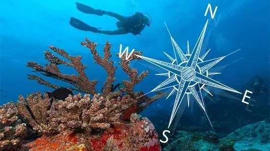
Effective navigators integrate natural environmental features with mechanical instruments rather than relying exclusively on one method. Sand ripple patterns align parallel to shorelines, sloping seabeds indicate depth gradients toward or away from beaches, and sunlight shadows reveal solar azimuths. Using natural topography as continuous confirmation while reserving compass bearings for featureless expanses reduces cognitive fatigue.
The Task-Loading Attention Funnel
Human working memory handles limited simultaneous inputs before shedding peripheral awareness. When a diver struggles with mask flooding, camera settings, or improper weighting, attention narrows exclusively onto immediate physical discomfort. Spatial tracking ceases entirely during task-loaded intervals, explaining why divers frequently emerge from brief distractions completely uncertain of their reciprocal heading.
Key Categories or Variations
Magnetic Compass Tilt and Lock Errors
Traditional analog compasses contain floating magnetic cards that bind against internal housings if tilted more than fifteen degrees off horizontal. Divers swimming with improper trim or holding wrist units at steep angles misread frozen needles as valid headings.
Uncompensated Lateral Current Drift
Swimming along a strict magnetic bearing while a perpendicular current flows across the reef moves the diver diagonally across the seabed. Failing to crab into the current results in missing the anchor line despite maintaining an accurate compass heading.
Reciprocal Heading Calculation Blunders
Adding or subtracting one hundred eighty degrees under mild nitrogen narcosis frequently produces basic arithmetic errors. Turning onto an incorrect reciprocal bearing sends divers swimming parallel to the shoreline rather than back toward the exit point.
Tunnel Vision on Marine Life
Following a sea turtle or schooling barracuda away from primary reef contours breaks spatial continuity. Once the animal disappears into open water, the diver lacks recognizable landmarks to re-establish positional awareness.
Inconsistent Kick-Cycle and Time Estimation
Measuring distance via fin kicks fails whenever finning cadence fluctuates due to fatigue, current resistance, or heavy camera drag. Assuming twenty kick cycles equal thirty meters across varying conditions introduces massive distance errors.
Depth-Profile Ignorance on Sloping Terrain
Ascending or descending carelessly along sloping coral walls shifts divers onto entirely different reef terraces. Returning at a shallower depth than the outbound swim often places the diver directly above the boat without spotting the mooring line below.
Decision Logic for Wayfinding Execution
Preventing common scuba diving navigation mistakes requires selecting navigation tools matched to specific underwater terrain. Over complex coral gardens with clear visibility, terrain association combined with depth-contour tracking outperforms constant compass staring. Across barren sand flats, turbid quarries, or open blue water, strict compass discipline paired with timed swim legs becomes mandatory.
Detailed Real-World Scenarios
Scenario One: Missing the Mooring Line on a Drift-Prone Reef
A buddy pair descends onto an offshore pinnacle where a mild surface current masks stronger water movement near the bottom. Swimming outward along a ninety-degree heading for fifteen minutes, they fail to notice the current pushing them northward across the reef plateau. Upon turning to a two-hundred-seventy-degree reciprocal heading, they swim parallel to the boat rather than toward it. Low on cylinder pressure, they surface three hundred yards down-current, requiring an arduous surface swim against choppy waves.
Scenario Two: Magnetic Interference Inside a Steel Shipwreck
Exploring the exterior hull of a sunken steel freighter, a diver relies on a wrist-mounted magnetic compass to locate the stern ascent line. Massive iron deck plates deflect the compass needle forty degrees off magnetic north without any obvious visual warning. Trusting the distorted readout, the diver swims away from the wreck into open sand. Recognizing that ferrous metal invalidates magnetic instruments prevents false reliance near wrecks.
Scenario Three: Shore Entry Disorientation in Low-Visibility Surge
Entering through coastal surf, a diver descends into murky water with five-foot visibility and strong bottom surge. Attempting to count kick cycles while getting pushed backward by wave energy distorts distance perception entirely. Rather than surfacing repeatedly to check shore landmarks, the diver uses sand ripple alignment—which always runs parallel to the beach—to maintain perpendicular orientation toward shallow water.
Scenario Four: Multi-Level Wall Swim Depth Mismatch
During an outbound swim along a vertical drop-off, a diver explores ledges at eighty feet before ascending gradually to forty feet for the return leg. Because the reef wall angles outward toward the shallows, swimming back at forty feet shifts the diver horizontally away from the boat’s anchor chain anchored at seventy feet. Matching return depth profiles to outbound contours ensures direct visual interception of descent lines.
Planning, Cost, and Resource Dynamics
Financial Investments in Reliable Navigation Hardware
Investing in precision instrumentation eliminates mechanical failure modes common in bargain gear. Tilt-compensated digital compasses and high-visibility analog gauges represent modest capital outlays compared to charter fees wasted on aborted dives.
Operational Costs of Navigational Failures
Losing orientation underwater carries substantial indirect costs beyond physical exhaustion. Missing boat pickup windows delays charter schedules, forces premature ascents that sacrifice paid bottom time, and increases risks of boat-strike hazards during unexpected open-water surfacings. Addressing common scuba diving navigation mistakes protects both financial investments and personal safety margins.
Tools, Strategies, and Support Systems
Side-Window Analog Compasses
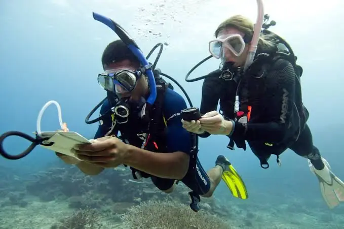
Quality liquid-filled compasses feature both top-down dials and side-reading windows. Side windows allow divers to hold the instrument straight ahead at eye level while swimming horizontally, maintaining clear forward vision of obstacles and buddies simultaneously.
Digital Tilt-Compensated Electronic Compasses
Integrated into modern dive computers, electronic compasses utilize three-axis accelerometers to display accurate bearings even when tilted up to forty-five degrees. Many models store outbound headings automatically and display directional arrows guiding divers back along reciprocal courses.
Primary Reels and Exploration Spools
When penetrating overhead environments or navigating silty bottoms where landmarks vanish, physical braided nylon lines provide absolute spatial certainty. Tying off a line at the entry point guarantees a direct physical path back regardless of visibility collapse.
Underwater Wetnotes and Pre-Dive Sketch Maps
Drawing simplified site maps on waterproof slates before submerging solidifies mental spatial models. Recording outbound compass bearings, depth transitions, and notable rock formations eliminates reliance on fallible underwater memory.
Transit Ranges and Visual Alignment
Aligning two stationary underwater objects—such as a distinct coral bommie and a distant rock pinnacle—creates an unmistakable visual sightline. Monitoring how those two objects shift relative to one another reveals subtle lateral current drift immediately.
Delayed Surface Marker Buoys (DSMBs)
Carrying a deployable surface marker buoy provides critical safety redundancy when navigational errors prevent returning to the primary anchor line. Inflating a high-visibility tube during safety stops alerts boat captains to exact diver locations well before surfacing.
Risk Landscape and Failure Modes
Compounding Fatigue and Air Depletion
When divers realize they have missed their exit point, elevated heart rates accelerate respiratory gas consumption rapidly. Swimming long distances against surface currents with depleted cylinders invites severe physical exhaustion and drowning risks.
Boat Traffic Hazards During Unplanned Surfacings
Surfacing away from designated mooring buoys places divers directly inside active maritime transit lanes. Without a deployed surface marker buoy, low-profile black wetsuits and hoods become virtually invisible to approaching vessel helmsmen.
Out-of-Air Emergencies During Extended Return Swims
Continuing underwater navigation searches after crossing minimum reserve gas thresholds transforms minor disorientation into life-threatening out-of-air emergencies. Strict adherence to rule-of-thirds or fifty-bar reserve turnarounds prevents running dry beneath the surface.
Governance, Maintenance, and Long-Term Adaptation
Pre-Dive Site Briefing and Bearing Verification
Before entering the water, divers should stand on the boat deck or shoreline and shoot an initial compass bearing toward the planned dive trajectory. Aligning the rotating bezel index marks on the surface prevents rushed underwater adjustments.
Post-Dive Compass Inspection and Care
Exposure to direct sunlight and extreme heat expands internal compass fluids, forming air bubbles that jam magnetic cards. Rinsing instruments in fresh water and storing them in shaded gear bags preserves needle responsiveness across years of service.
Subaquatic Navigation Verification Checklist
-
Surface Bearing: Capture magnetic heading from entry point toward primary reef target before descending.
-
Depth Contour Check: Note exact bottom depth at the anchor line or shore entry marker for return matching.
-
Look-Back Protocol: Turn completely around immediately after reaching the bottom to memorize how the exit landmark looks from behind.
-
Turnaround Trigger: Initiate return navigation promptly upon reaching half-tank pressure or planned time limits.
-
Surface Marker Readiness: Verify DSMB and finger spool attachment prior to executing open-water ascents.
Measurement, Tracking, and Evaluation
Leading Indicators of Wayfinding Proficiency
Evaluating navigation competence proactively involves practicing square and triangle compass patterns over featureless sand beds while blindfolded or looking strictly at instruments. Closing geometric patterns within two meters of starting markers demonstrates calibrated kick pacing and heading discipline.
Lagging Indicators and Post-Dive Log Audits
Reviewing GPS entry and exit coordinates recorded by modern dive computers exposes hidden drift patterns over multiple dives. Comparing planned underwater tracks against actual surface surfacing locations reveals whether lateral currents or finning asymmetries systematically skew trajectories.
Common Misconceptions and Oversimplifications
The Myth That Turning Around Automatically Shows the Entry Point
Reef formations, coral overhangs, and rock pinnacles look completely different when viewed from opposite directions. Divers who fail to look backward during their outbound swim rarely recognize familiar landmarks on the return leg.
Believing Digital Compasses Never Require Calibration
Electronic compasses rely on magnetometers sensitive to nearby metallic dive lights, camera strobes, and magnetic buckle clips. Failing to calibrate digital instruments after changing battery packs or wrist configurations produces persistent angular drift.
Assuming Sun Position Remains Constant Throughout Long Dives
During late afternoon or early morning dives, rapid solar angle changes alter shadow directions across the seabed significantly over sixty minutes. Relying exclusively on sunlight angles without cross-checking magnetic bearings leads to gradual directional error.
Thinking Only the Dive Leader Needs to Navigate
Passively following a dive guide without tracking personal headings creates total vulnerability if buddy separation occurs. Every certified diver must maintain independent spatial awareness throughout every submersion.
Ethical, Practical, and Contextual Considerations
Protecting Fragile Reefs During Orientation Checks
Stopping abruptly to inspect compasses or write on slates often causes poorly weighted divers to sink onto delicate coral heads. Achieving neutral buoyancy well above the seabed before consulting instruments prevents accidental ecological damage.
Respecting Diver Autonomy and Conservative Turnarounds
Refusing to push deeper or farther into unfamiliar territory when spatial certainty wavers demonstrates mature diving judgment. Aborting an exploratory leg early to execute a controlled ascent preserves safety margins for the entire dive team.
Conclusion
Subaquatic spatial orientation requires deliberate mental discipline to overcome the sensory distortions of the underwater world. By recognizing common scuba diving navigation mistakes—from compass tilt errors and uncompensated current drift to wildlife tunnel vision—divers replace guesswork with structured environmental awareness. Integrating natural topography cues with calibrated magnetic instruments, strict turnaround thresholds, and pre-dive look-back habits ensures reliable returns to exit points across diverse marine conditions. Ultimately, mastering underwater wayfinding transforms stressful searches into calm, observant exploration beneath the waves.